- Photos & Map
How would you like to arrive?
- Description
- Good to know
- Nearby
- 5:00 h
- 12.97 km
- 861 m
- 467 m
- 1,923 m
- 2,333 m
- 410 m
- Start: Riederalp, top station of the West gondola
- Destination: Moosfluh, top station of Moosfluh glacier cable car
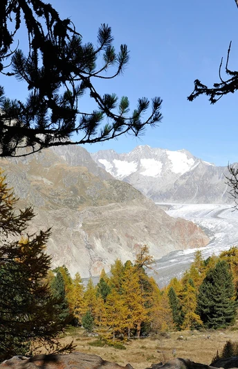
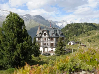
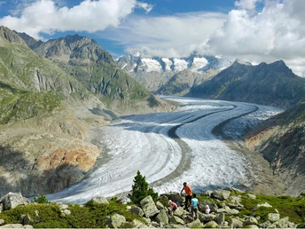
From Riederalp West you hike up to Riederfurka, where the impressive Villa Cassel with the Pro Natura Aletsch Center is located. Then follow the Lengmoosweg towards the bishop’s seat. The path leads you through the protected Aletsch forest with its ancient larches. Stay on this path until you reach the signpost Breitebode – Moosfluh – Biel, and switch to the trail that leads high toward the ridge. At Biel, the path branches off to the Chatzulecher lakes, known for their emerald green waters. Step by step, you approach the Great Aletsch Glacier on this downhill section. For the return, take the same path back to Biel and then hike westwards to the Moosfluh viewpoint. From there, take the Moosfluh glacier cable car down to Riederalp. Alternatively, from Biel you could descend directly to Riederalp.
Good to know
Pavements
Best to visit
Directions
Tour information
Stop at an Inn
Equipment
We recommend:
- Good footwear
- Weather-dependent clothing: always carry a waterproof vest
- Headgear
- Sun protection
- Water bottle
- Picnic
- Camera
- Binoculars (optional)
- Walking poles (optional)
- Printout of the hiking trail (click “Print” to download)
Directions & Parking facilities
- Limited number of paid parking spaces at Mörel-Filet station. Further parking options are signposted.
- Large paid parking garages at the entrance to Mörel-Filet as well as in the village center.
Additional information
Aletsch Arena AG
Furkastrasse 39
CH-3983 Mörel-Filet
+41 27 928 58 58
info@aletscharena.ch
www.aletscharena.ch
Literature
You can get a free panorama map at the cable cars and information centers of Aletsch Arena.
Author´s Tip / Recommendation of the author
Safety guidelines
Use of the hiking trails and information on this website is at your own risk. Conditions on site may cause changes to the route. Aletsch Arena AG assumes no responsibility for the accuracy and completeness of the information on this website.
- Carry a map with you. Download the complete description of the hiking trail with a large-scale map by clicking “Print” at the top right of the page.
- Use only marked hiking trails and observe all signposts and instructions—for your own safety, to protect grazing animals, and out of respect for wildlife.
- Close gates after passing through.
- Be considerate of other trail users, plants, and animals.
Map
Nearby


