- Photos & Map
How would you like to arrive?
- Description
- Good to know
- Nearby
Download GPX file
- 1:10 h
- 5.35 km
- 32 m
- 32 m
- 1,368 m
- 1,400 m
- 32 m
- Start: Oberwald, village
- Destination: Oberwald, village
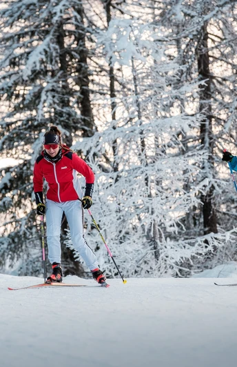
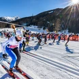
Those who like to move in the snow-covered mountain forest will find the Waldloipe just right. The perfectly groomed piste with Scandinavian flair runs through the "Pischäwald" in a variety of ways. This is what the locals here affectionately call their protective mountain forest, which lines the village of Oberwald.
At the Goneri Bridge, the cross-country skier decides which route to take. The first recommended trail is the loop that runs into the Eye after crossing the young Rhone on the wooden arch bridge. The other round takes place in the picturesque landscape of the Sand area.
As the track can only be prepared as single trail, it is advisable to follow the directions. This is a simple way to avoid bottlenecks.
The Loipe Goms network offers a good connection to the Waldloipe. From Oberwald train station it is only a good 700 metres to the entrance.
Thanks to its sheltered location, the Waldloipe is a true cross-country skiing delight even in windy conditions or in snowfall.
Good to know
Best to visit
Directions
Oberwald, Dorf - Piische - Goneri-Brücke - Holzbogenbrücke - Eye - Holzbogenbrücke - Goneri-Brücke - Sand - Goneri-Brücke - Piische - Oberwald, Dorf
Tour information
Loop Road
Equipment
We recommend:
- Good cross-country skiing material
- Weatherproof (waterproof and windproof) warm clothing and headgear
- Sunglasses
- Good sun protection, even in cloudy weather. UV rays at high altitudes can be very strong, especially in winter.
Directions & Parking facilities
The timetables for the car transport Furka can be found at www.matterhorngotthardbahn.ch
Additional information
- Winter sports report at www.goms.ch/en/winter-sports-report
- Time table www.sbb.ch
- Telephone number rescue service: 144
- Winter hikers, snowshoe trekkers and dog owners are not allowed to enter the cross-country ski runs.
Literature
- Winter map of Obergoms with cross country trail plan
- Holiday companion
Author´s Tip / Recommendation of the author
With the cross-country ski pass of the Loipe Goms, you travel free of charge on the MGBahn route Oberwald-Fiesch during the period of validity. Even without cross-country skiing equipment!
Safety guidelines
The Goms cross-country ski trail network is open from 9am to 4pm. The use of the trails is at your own risk. Obergoms Tourismus AG and Loipe Goms disclaim all liability and assume no responsibility for the accuracy and completeness of the information on this website.
Use only marked trails and follow all markings and signs - for your own safety, for the protection of the landscape and in respect of wildlife.
Be considerate towards other cross-country skiers. Every cross-country skier, especially on downhill runs, must adapt speed and behaviour to his ability and visibility. In classic running tracks and on the piste for free running technique, you run on the right side of the piste with an appropriate safety distance to the front runner. If you stop, you step out of the cross-country ski run. Assistance in case of accidents is a matter of course. To alert the rescue service, dial No. 144.
Weather conditions in the mountains can change very quickly and without warning. Appropriate clothing is very important.
The winter sports report keeps you informed about the current conditions (avalanche danger, cross-country skiing, winter hiking trails, snow trails and road conditions).
Map
Nearby


