- Photos & Map
How would you like to arrive?
- Description
- Good to know
- Nearby
- 2:00 h
- 5.33 km
- 181 m
- 194 m
- 1,881 m
- 2,069 m
- 188 m
- Start: Bettmeralp, mountain station Bettmeralp cable car
- Destination: Riederalp Mitte
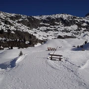
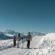
The start is at the mountain station of the Bettmeralp cable car, from where you hike down to the valley station of the Bettmerhorn gondola and then continue leisurely up to the nearby Bettmersee. From there, follow the path westward. Passing the cross-country ski trail and the Blausee-Schönbodu slope, the path first runs flat then ascends towards the middle station of the Blausee chairlift. At the reservoir, you go through the piste underpass. You share the flat section to the Golmenlift mountain station with sledders. At the mountain station, you pass the Golmenlift and then hike parallel to the slope downward to the Alpstallung Gopplerlücke and further to the valley station of the Moosfluh glacier railway. From there, the path continues westward to Riederalp Mitte.
Good to know
Best to visit
Directions
Bettmeralp – Bettmersee – Gopplerlücke - Riederalp Mitte
Equipment
We recommend:
- Good footwear
- Weather-dependent (waterproof) and warm clothing
- Headgear
- Sun protection
- Provisions
- Camera
- Hiking poles (optional)
- Printout of the hiking trail (click "Print" to download)
Directions & Parking facilities
Via cantonal road 19 to the exit Bettmeralp valley station. Take the Bettmeralp cable car (Aletsch Bahnen AG) up to Bettmeralp.
Large fee-based parking lot/garage at the valley station of the Bettmeralp cable car (Aletsch Bahnen AG).
Take the train from Brig or Oberwald to Bettmeralp valley station. Take the Bettmeralp cable car (Aletsch Bahnen AG) up to Bettmeralp.
Additional information
Furkastrasse 39
CH-3983 Mörel-Filet
+41 27 928 58 58
info@aletscharena.ch
www.aletscharena.ch
Literature
Author´s Tip / Recommendation of the author
Safety guidelines
Use of the winter hiking trails and information on this website is at your own risk. Conditions on site may cause changes to the route.
Carry a map with you. Download the complete description of the hiking trail along with a large-scale map by clicking "Print" at the top right of the page.
Use only marked hiking trails and follow all signposts and instructions – for your own safety, to protect livestock and to avoid disturbing the peace of wildlife.
Be considerate towards other trail users and the landscape. Take your trash and that of others with you.
Carry additional sun protection. UV rays at high altitudes can be very strong, especially in winter, even in cloudy weather.
Plan your hike carefully: consider the required fitness of all participants, weather forecasts and seasonal dependencies.
Weather conditions can change very quickly and without warning in the mountains. Appropriate clothing and sufficient provisions (food and drink) are very important. Turn back early in case of unstable weather.
Do not venture onto glaciers without a mountain guide.
Observe warning signs indicating dangers, especially avalanche hazard.
Inform third parties about your route and, if possible, never go alone.
Note(s)
Due to altitude and trail routing, good footwear is absolutely required for this winter hike.
Nearby


