- 5:00 h
- 12.77 km
- 1,293 m
- 192 m
- 1,109 m
- 2,369 m
- 1,260 m
- Start: Fieschertal
- Destination: Fiescheralp
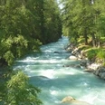
The route starts at the village square in Fieschertal. From there you follow the valley-bound asphalt road towards Unnerbärg until on the left the mountain path branches off to Stock. The path quickly gets steeper and leads over a scree field directly to a rock face with a small waterfall. From here the route becomes even more challenging: over rock slabs the path winds up to Stock. You will be rewarded for the effort with a view of the Fiescher Glacier. After you have managed the steep ascent over rock, you continue hiking uphill over alpine meadows to Märjelenwang. The next destination is the Märjelensee region with the Vordersee, right by the mountain hut Glacier Hut. On the return you hike via Oberes Tälli (through the 1 km long, illuminated Tälligrat tunnel) to Salzgäb and from there to Fiescheralp. Take the cable car down to Fiesch and travel by post bus back to Fieschertal.

Good to know
Pavements
Best to visit
Directions
Fieschertal – Unnerbärg – Stock – Märjelenwang – Märjelensee – Fiescheralp
Tour information
Stop at an Inn
Equipment
We recommend:
- Good footwear
- Weather-dependent clothing: always carry a waterproof vest
- Headwear
- Sun protection
- Water bottle
- Picnic
- Camera
- Binoculars (optional)
- Trekking poles (optional)
- Printout of the hiking trail (click "Print" to download)
Directions & Parking facilities
Drive via Cantonal Road 19 to the Fiesch exit and then continue via Fieschertal Road to Fieschertal.
Limited number of paid parking spaces at the village square in Fieschertal.
Additional information
Furkastrasse 39
CH-3983 Mörel-Filet
+41 27 928 58 58
info@aletscharena.ch
www.aletscharena.ch
Literature
Author´s Tip / Recommendation of the author
From the Platta viewpoint, you have a great view of the Great Aletsch Glacier! Plan about 30 minutes walking time from the Glacier Hut.
Safety guidelines
Use of the hiking trails and information on this website is at your own risk. Conditions on site may cause changes to the route. Aletsch Arena AG accepts no responsibility for the accuracy and completeness of the information on this website.
- Carry a map with you. Download the full description of the hiking trail with a large-scale map by clicking "Print" at the top right of the page.
- Use only marked hiking trails and follow all signs and instructions - for your own safety, to protect grazing animals and out of respect for wildlife.
- Close gates after passing through.
- Behave considerately towards other trail users, plants and animals.
Map
Nearby