


- 1:50 h
- 8.80 km
- 57 m
- 28 m
- 1,338 m
- 1,396 m
- 58 m
- Start: Obergesteln, train station
- Destination: Münster, Furkastrasse
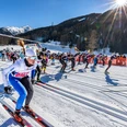
The Sonnenloipe offers a sense of freedom and lightness. The perfectly groomed cross-country ski track runs picturesquely across the snow-covered scenery on the right bank of the Rhône valley from Oberwald to Münster. Thanks to its gentle gradient, this track is ideal for beginners. The Sonnenloipe can be easily combined with the other Loipe Goms cross-country ski tracks.
The section from Obergesteln to Geschinen, known as the Herz-Loipe,
has been developed in collaboration with the Swiss Heart Foundation and Loipen Schweiz to encourage people with heart conditions to stay physically active. It is particularly well-suited for a moderate endurance workout.
There are plenty of dining options along the way. Take the opportunity to enjoy a warm soup, a homemade cake, or something savoury on one of the many sunny terraces along the Sonnenloipe.

Good to know
Best to visit
Directions
The Sonnenloipe begins at Oberwald station and heads towards Obergesteln station. Here, cross the station briefly on foot before gliding further along the open fields at the village exit. The route follows the Tällibach stream, leading to Ulrichen, where you cross the main road and enter the sunny atmosphere of the Goms valley. Continuing towards Geschinen, cross the Geschinerbach and pass by Baschi Restaurant. You will soon reach Geschinen station, where a short, steep section awaits, leading towards Münster, where the Sonnenloipe ends.
Tour information
Familiy-Friendly
Stop at an Inn
Equipment
We recommend:
- Good cross-country skiing equipment
- Suitable clothing depending on the weather (waterproof and windproof) warm clothing
- Hat or cap
- Sunglasses
- Hydratation
- Good sun protection, even in cloudy weather. UV rays at high altitudes can be very strong, especially in winter.
Directions & Parking facilities
From Brig follow cantonal road No 19 (Furkastrasse) for 41 km to Oberwald.
The Goms valley is also easily accessible from Zurich / Lucerne via Andermatt – Furka car transport.
The Furka, Grimsel and Nufenen alpine passes are closed in winter.
Relevant timetables for the Furka car transport can be found at www.matterhorngotthardbahn.ch
There is limited parking available near the railway station and in Oberwald village. Be sure to follow the local parking guidance system.
Public-transport-friendly
By train from Monthey, Martigny, Sion, Sierre and Visp: Exit in Brig. Then take the Matterhorn Gotthard Bahn regional train (R43). After 1h23, exit the train in Oberwald.
The Goms valley is also easily accessible from Zurich / Lucerne via the Andermatt- Furka tunnel.
Relevant timetables for all connections can be found at www.sbb.ch
Additional information
- Winter sports report at http://www.goms.ch/en/winter-sports-report
- Time table www.sbb.ch
- Telephone number rescue service: 144
Winter hikers, snowshoe hikers and dogs are not allowed to enter the cross-country skiing slopes.
Literature
- Winter map of Obergoms with cross country trail plan
- Holiday companion
Author´s Tip / Recommendation of the author
With a valid Loipepass from Loipe Goms, you can travel for free on the Matterhorn Gotthard Railway between Oberwald and Fiesch – even without cross-country skiing equipment.
Safety guidelines
The Goms cross-country ski trail network is open from 9am to 4pm. The use of the trails is at your own risk. Obergoms Tourismus AG and Loipe Goms disclaim all liability and assume no responsibility for the accuracy and completeness of the information on this website.
- Be considerate towards other cross-country skiers. Every cross-country skier, especially on downhill runs, must adapt speed and behaviour to his/her skill and the current visibility. On the classic and free skating tracks always overtake skiers on the right hand side with an appropriate safety distance. If you stop, step out of the cross-country skiing slope.
- The winter sports report keeps you informed about the current conditions (avalanche danger, cross-country skiing, winter hiking trails, snow trails and road conditions).
- Use marked trails only, and observe all signposting – for your own safety, to safeguard grazing animals and to avoid disturbing wildlife.
- Please be considerate to other trail users, and to the plants and animals. Do not leave any waste in nature, take with you waste from others.
- Weather conditions can change quickly in the mountains, without warning. Appropriate clothing is therefore essential.
- Take note of the warning signs that point out the constant danger, especially the danger of avalanches.
- Assistance in case of accidents is a matter of course. To alert the rescue service, dial No. 144
Map
Nearby

