- Photos & Map
How would you like to arrive?
- Description
- Good to know
- Nearby
- 4:50 h
- 14.11 km
- 457 m
- 1,108 m
- 1,552 m
- 2,374 m
- 822 m
- Start: Fiescheralp, mountain station of the Fiesch-Eggishorn cable car
- Destination: Bellwald
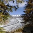
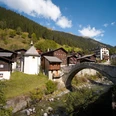
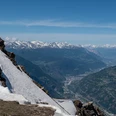
From the Fiescheralp mountain station, hike eastwards via Salzgäb, Oberes Tälli (through the illuminated tunnel) to Märjelensee. At the mountain restaurant Gletscherstube, follow the path over Märjelenwang and Stock down to the Burghütte, then reach the Aspi-Titter suspension bridge. This section is relatively demanding, steep and requires sure-footedness. About 600 meters of elevation descent must be overcome here. The subsequent crossing of the suspension bridge also requires a head for heights. Once on the other side, continue hiking downhill via Obflie, Ried and Gasse to the village center of Bellwald. From there, take the cable car down to Fürgangen and return by train to Fiesch.
Good to know
Pavements
Best to visit
Directions
Tour information
Stop at an Inn
Equipment
We recommend:
- Good footwear
- Weather-dependent clothing: always carry a waterproof vest
- Headgear
- Sun protection
- Water bottle
- Picnic
- Camera
- Binoculars (optional)
- Hiking poles (optional)
- Printout of the hiking trail (click "Print" to download)
Directions & Parking facilities
Additional information
Furkastrasse 39
CH-3983 Mörel-Filet
+41 27 928 58 58
info@aletscharena.ch
www.aletscharena.ch
Literature
Author´s Tip / Recommendation of the author
Safety guidelines
Use of hiking trails and information on this website is at your own risk. On-site conditions may cause changes to the route. Aletsch Arena AG assumes no responsibility for the accuracy or completeness of the information on this website.
- Crossing the Aspi-Titter bridge requires sure-footedness and a head for heights.
Carry a map with you. Download the complete description of the hiking trail with a large-scale map by clicking "Print" at the top right of the page.
Use only marked hiking trails and observe all signs and instructions – for your own safety, for the protection of grazing animals, and out of respect for wildlife.
Close gates after passing through.
Be considerate of other trail users, plants, and animals.
Carry additional sun protection. UV rays at high altitudes can be very strong, even in cloudy weather.
Plan your hike carefully: consider the required fitness level of all participants, weather forecasts, and seasonal conditions.
Weather conditions in the mountains can change very quickly and without warning. Appropriate clothing and sufficient provisions (food and drink) are very important. In unstable weather, better turn back early.
Map
Nearby


