- Photos & Map
How would you like to arrive?
- Description
- Good to know
- Nearby
- 3:00 h
- 7.99 km
- 101 m
- 263 m
- 1,190 m
- 1,453 m
- 263 m
- Start: Blatten near Naters
- Destination: Ried-Mörel
The Massa Gorge was formed by the activity of the Great Aletsch Glacier. The ice carved this gorge into the rock a long time ago – since then the canyon has been further shaped by the glacial water. From inside the gorge, one can no longer see the mightiest glacier of the Alps. This glacier, measuring 23 km in length and containing 27 billion tons of ice, forms the heart of the UNESCO World Heritage Swiss Alps Jungfrau-Aletsch.
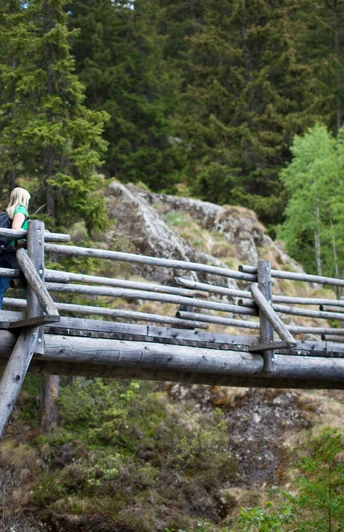
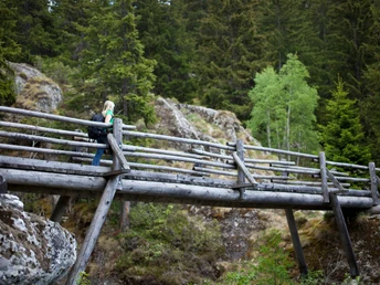
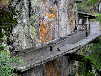
The dizzying gorge is the highlight of this hike and follows the historic Riederi irrigation channel. This channel was first mentioned in historical documents in 1385 and carried meltwater from the glacier to the fields near Ried-Mörel. The Riederi is no longer operational, but the path follows the channel's course, which was painstakingly carved into the rock. These sections make the hike an adventurous experience recommended only for those free of vertigo.
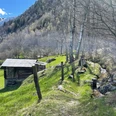
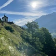
The hike starts in Blatten near Naters and climbs in the forest up to the Gibidum Bridge. Once on the other side of the Massa, the path sharply turns south. First it follows the gorge downward on a newly blasted, airy path high above the impressive Massa Gorge, before branching northwest towards the Rhone Valley. Here hikers roam through forests and pastures until they reach Ried-Mörel.
The section along the Riederi was designed as an experiential trail around the theme of water. The historic methods of transporting water along slopes to the fields are similarly used in Nepal. Information panels (in German and French) explain the similarities of the two traditions, highlight the extraordinary effort for construction and maintenance, and let you discover the customs and myths linked to this tradition.
Highlights of the hike
- Varied hike through forests, through the spectacular gorge and over meadows with breathtaking views.
- Short ascent at the start of the hike. Afterwards, it runs pleasantly flat – however, being free of vertigo is a must.
- Experiential trail about water usage in Valais and Nepal
Good to know
Pavements
Best to visit
Directions
The route is signposted as “Massaweg” and starts in Blatten near Naters. The themed path itself follows the signs “Water connects”.
The easiest way from the end point back to the valley floor is via the gondola lift from Ried-Mörel to Mörel Station. This last section can also be done on foot.
Tour information
Cultural Interesting
Equipment
We recommend:
- Good footwear
- Weather-dependent clothing: always carry a waterproof vest
- Headgear
- Sunscreen
- Water bottle
- Picnic
- Camera
- Binoculars (optional)
- Walking sticks (optional)
- Printout of the hiking trail (click “Print” to download)
For certain hikes:
- Swimsuit
Directions & Parking facilities
Additional information
More information about the destination:
Literature
The tourism offices in Blatten as well as in the Aletsch Arena provide you with informational material and brochures about hiking in the destination.
Author´s Tip / Recommendation of the author
Safety guidelines
The mountains, a place of joy to share and respect. The mountain world is a place to meet and experience unforgettable moments together – whether by bike or on foot. To ensure everyone can benefit, it is essential to share this space with respect for nature and agriculture. Respectful behavior allows everyone to enjoy their leisure activities under the best conditions. Inform yourself about recommendations and rules. Assess your own skills and fitness well. Using the various routes is always at your own risk.
For all hikes:
- Carry a map with you. Download the complete description of the hiking trail with a large-scale map by clicking “Print” at the top right of the page.
- Use only marked hiking trails and observe all signs and instructions - for your own safety, to protect grazing animals, and out of respect for wildlife.
- Close gates after passing through.
- Behave considerately towards other path users, plants, and animals.
For mountain hikes:
- Carry additional sun protection. UV rays at high altitudes can be very strong, even on cloudy days.
- Plan your hike carefully: Take into account the required fitness level of all participants, weather forecasts, and seasonal dependencies.
- Weather conditions in the mountains can change very quickly and without warning. Suitable clothing and enough provisions (food and drink) are very important. In unstable weather, it's better to turn back early.
For high alpine hikes:
- Inform your family about your hiking route. If possible, avoid being alone.
- Do not venture onto glaciers without a mountain guide.
- Observe warning signs indicating dangers at riverbanks, along watercourses below dams and reservoirs: water levels can rise quickly and without warning.
Map
Nearby


