- Photos & Map
How would you like to arrive?
- Description
- Good to know
- Nearby
Download GPX file
- 5:00 h
- 11.48 km
- 1,365 m
- 579 m
- 1,037 m
- 2,352 m
- 1,315 m
- Start: Valley station, Rosswald
- Destination: Mountain station, Rosswald
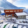
The hike described here starts at the valley station of the Rosswald cable cars in Ried-Brig. It is also possible to take the PostBus from Brig to Termen and start the hike from Termen, village square.
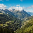
During the ascent, the view slides towards the Aletschhorn and Aletsch Arena. Later, the hiker overlooks the Rhone Valley with the alpine towns Brig-Glis and Naters. Along the Tunetschgraben, the path climbs over 1,300 meters in elevation to the summit cross on the Kläna.
On the old military paths of Rosswald, you hike down to the Rosswald alpine pasture. During the descent, the view opens up to the Brigerberg plateau with Termen and Ried-Brig, as well as the Riedalpji.
Upon arrival in Rosswald, you can refresh yourself in the restaurants or the grocery store. The descent is possible via the 36-er Weg or also with the gondola.
Good to know
Pavements
Best to visit
Directions
The hike described here starts at the valley station of the Rosswald cable cars in Ried-Brig. It is also possible to take the PostBus from Brig to Termen and start the hike from Termen, village square.
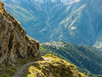
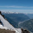
After about an hour of walking, you are well warmed up and reach the old slate mountain of Termen. From here begins the ascent that defines the hike. The path winds diversely up the ridge. First, the view slides towards the Aletschhorn, which presents itself from Termen in probably its most beautiful aspect. Later, the hiker overlooks the Rhone Valley with the alpine towns of Brig-Glis and Naters in the foreground.
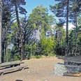
Soon you reach the recreational area at z’Gartu. There are huts and tables where you can take a short rest. The fountain supplies hikers with fresh mountain water. The hiking trail ascends gently along the gravel road and then turns left into the forest.
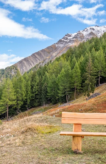
Now begins the exciting ascent. Along the Tunetschgraben, the path climbs over 500 meters in elevation over the next 2.5 kilometers. You reach Mattalpji. Formerly used as a fore-alp, the pasture has been fallow for several years. Still visible are fountains and old water pipes that supplied the alp with water from the Tunetschgraben. There is a bench in the clearing where you can rest. The spot is also ideal for a lunch break.
From Mattalpji, you hike another two kilometers to the highest part of the hike, the cross on the Kläna. This involves climbing another 450 meters in elevation.
At Kläna, the hiker is rewarded with a breathtaking view. You can let your gaze wander from the Wasenhorn in the south, across the Simplon Pass, the summit of the Matterhorn to the Glishorn into the Rhone Valley. On the right side of the Rhone Valley, beyond Belalp, Riederalp, and Bettermalp, you look further up into the high valley of Goms.
On the old military paths of Rosswald, you hike down to the Rosswald alpine pasture. During the descent, the view opens up to the Brigerberg plateau with Termen and Ried-Brig, as well as the Riedalpji.
Upon arrival in Rosswald, you can refresh yourself in the restaurants or the grocery store. Those who have not had enough can tackle the descent via the 36-er Weg to the Rosswald valley station. However, most will be glad that the Rosswald cable car takes hikers back to the starting point.
Tour information
Loop Road
Stop at an Inn
Summit
Equipment
Directions & Parking facilities
By PostBus from Brig station towards Rosswald, valley station or Termen, village square.
More about the schedule at: www.sbb.ch
Additional information
You can get information about the hike at the tourist offices in Brig and Rosswald.
The timetable of the Rosswald cable cars is available here: www.rosswald-bahnen.ch
More hikes can be found at this link.
Literature
“Hiking at Simplon”
The publication “Hiking at Simplon” (2008) is a true treasure trove of stories and facts from a wide range of fields.
Dr. Klaus Anderegg edited numerous contributions by authors into an impressive comprehensive view. On 368 pages, eight routes of the unique alpine and mountain region Simplon are presented with a great variety of natural, cultural, and historical treasures and curiosities.
CHF 48.— plus packaging and shipping; available from the Ecomuseum Simplon, 3907 Simplon Village, ecomuseum@simplon.ch (ISBN: 978-3-905756-31-9)
Author´s Tip / Recommendation of the author
Safety guidelines
Map
Nearby


