- Photos & Map
How would you like to arrive?
- Description
- Good to know
- Nearby
- 5:30 h
- 15.03 km
- 424 m
- 1,958 m
- 1,337 m
- 3,269 m
- 1,932 m
- Start: Allmagellerhütte SAC
- Destination: Bord, Zwischbergen
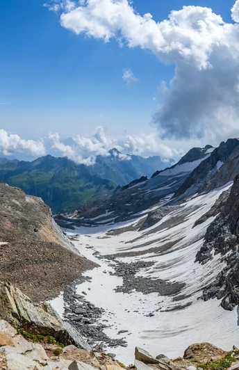
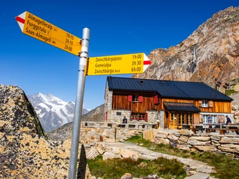
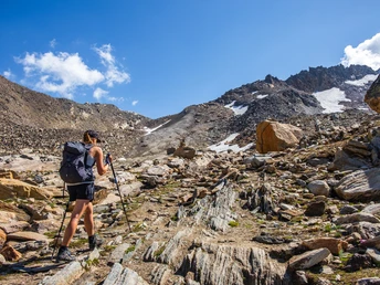
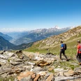
The day tour starts at the Allmagellerhütte, where there is an overnight accommodation option. After a 45-minute ascent (about 400 m), you reach the signpost at the Zwischbergen Pass. After a short scramble through large boulders, you reach the highlight of the tour, the Zwischbergenpass. The first steep and somewhat arduous descent over loose scree and rock to the snowfield follows. The further descent variant is ideally chosen based on the current snow conditions and tracks. The official route leads relatively close to the rock on the left down to the glacier moraine and the stream. After crossing the stream, the longer the trail, the greener it becomes. Rocks and scree give way to green meadows and alpine flowers. At "Zibelenflue" the last challenging section awaits, which is overcome safely with handrails. With a view of the Fa reservoir, the tour continues to descend past the shepherd's hut in Galki towards Gmeinalp. In Gmeinalp, numerous ruins bear witness to times gone by. The trail leads rather flat along the streambed into the Cheller and to the Fa reservoir. After a short, wide passage on a private road, the trail turns right and continues downhill through the forest. Along the "Great Water", the path turns left shortly before the destination in the direction of Zwischbergen, Bord.
This hike is very demanding. The last ascent over large stones to Zwischbergenpass and the descent over the loose scree and snow field to Zibelenflüe has an alpine character and must not be underestimated under any circumstances. Due to the natural conditions (snowfield, scree), the trail is not always clearly visible, but there are clearly visible markings in many places. Good preparation and equipment are absolutely essential for this tour.
Note
From Zwischbergen, Borf there is a call bus during the summer months. Reservations are essential up to 2 hours before departure or in the evening by 5.00 pm.
Good to know
Pavements
Best to visit
Directions
Tour information
Stop at an Inn
Equipment
- High mountain boots possibly suitable for crampons
- gloves
- cap
- Clothes adapted to the season and weather
- ice axe, rope and safety equipment
- maps 1:25 000
- altimeter
- First aid kit with rescue blanket
- cell phone
- Enough provisions
Directions & Parking facilities
Alternatively, take the post bus to Saas-Almagell, Sportplatz and walk to the station of the Furggstalden chairlift (note timetable). After the chairlift ride, walk along the Almagell adventure trail towards Almagelleralp and on to the Almagellerhütte SAC. This trail leads over two suspension bridges and is only recommended for hikers with a head for heights.
In the summer months, the Zwischbergental is served by a call bus. Book your journey with the call bus at least two hours before departure and in the evenings by telephone on 079 713 70 02. The bus only runs with reservations and takes you from Zwischbergen, board down to Gondo, church. To the timetable.
Additional information
Further information and tips on www.brig-simplon.ch
Author´s Tip / Recommendation of the author
Safety guidelines
- Choose a hike that is appropriate for your abilities
- Mountain hiking is an endurance sport. Only set off in a healthy and rested condition.
- Stay alert during the ascent and descent
- When planning, pay attention to current weather reports. Turn back early in case of bad weather
- Equipment should be adapted to the hike
- Good hiking shoes are mandatory to wear
- Always stay on marked trails. Shortcuts should be avoided
- Regular breaks with food and drink are necessary to maintain concentration and efficiency
- Hiking alone should be avoided Inform others about the planned route.
- Respect nature! Always take litter with you and observe regulations in protected areas.
All hikes are at the hiker's own risk. Insurance is the responsibility of the hiker.
Map
Nearby


