


- 3:30 h
- 10.38 km
- 184 m
- 377 m
- 672 m
- 900 m
- 228 m
- Start: Eggerberg train station
- Destination: Brig train station
When the pioneering Lötschberg Tunnel was opened in 1913, the first year-round connection between Valais and Bern was established. Together with the Simplon Tunnel, a fast and comfortable journey through the Alps became possible.
The section south of the Lötschberg summit tunnel from Kandersteg to Goppenstein is one of the region’s most popular hikes: the Lötschberger South Ramp was extended by another section during the 100-year anniversary celebrations of the line’s opening and now runs from Lalden station further to Brig.
The described hike starts in Eggerberg, west of Lalden, about 200 meters above the valley floor. From here, the hike follows the sunny southern flank of the Rhone Valley before the final descent down into the alpine town of Brig. Since the opening of the Lötschberg base tunnel in 2007, the railway line has become much quieter. 400 meters further below the mountain, Intercity and freight trains pass through the new base tunnel at speeds up to 250 km/h.
The first section of the hike runs quite close to the railway line. It passes above the Brigerbad thermal baths, one of the largest thermal baths in Switzerland with 12 indoor and outdoor pools, water slides, and a spa.
From here, the path continues above the railway line. It first passes below the Safran village of Mund and then follows the "Driestneri" irrigation channel, which was formerly used as a water supply for fire emergencies on the Lötschberg line.
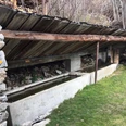
Shortly before reaching Naters, the path passes an old underground fortress. Today there are two museums inside: one about the military history of the fortress; the second about the Swiss Guard in the Vatican. Naters is the Swiss municipality which has sent the most mercenaries to the Vatican.
The South Ramp is mostly hiked towards Brig; but it is also very appealing in the opposite direction.
Highlights of the hike:
- Themed trail with information panels explaining the 100-year history of the Lötschberg railway line.
- Sunny location with great views of the Rhone Valley.
- Two fascinating museums in Naters as well as the alpine town of Brig with its historic charm and Mediterranean flair.

Good to know
Pavements
Best to visit
Directions
The hike begins at Eggerberg train station – the path is clearly signposted.
The first section briefly follows a road above the railway line before crossing it after about 1.7 km. The route then runs close to the railway line above the villages of Lalden and Brigerbad in the valley floor. When you are above the thermal baths in Brigerbad, you cross the railway line again and continue the hike above the track towards Brig. The access to the historic fortress with its museums is a few minutes to the right of the marked route.
The entire Lötschberger South Ramp runs about 27 km from Hohtenn station via Eggerberg to Brig.
The South Ramp is also part of the Valais Sunny Trail, a four-day hike along the southern flank of the Rhone Valley from Crans-Montana to Brig.
Tour information
Cultural Interesting
Stop at an Inn
Equipment
We recommend:
- Good footwear
- Weather-dependent clothing: always carry a waterproof vest
- Headwear
- Sunscreen
- Water bottle
- Picnic
- Camera
- Binoculars (optional)
- Trekking poles (optional)
- Printed hiking trail description (click "Print" to download)
For certain hikes:
- Swimsuit
Directions & Parking facilities
Regular train connections from all over Switzerland to Brig, then with the "RegioExpress" to Eggerberg. Detailed train timetables can be found at fahrplan.bls.ch
You can hike the Lötschberger South Ramp as a whole or in sections. Starting points are the stops Hohtenn, Ausserberg, Eggerberg, Lalden, and Brig.
Additional information
More information about the destination:
Literature
Author´s Tip / Recommendation of the author
Safety guidelines
Use of the hiking trails and information on this website is at your own risk. Conditions on site may cause changes to the route. Valais/Wallis Promotion accepts no responsibility for the accuracy and completeness of the information on this website. Assess your own abilities and fitness well. Traveling the various routes is fundamentally at your own responsibility.
For all hikes:
- Carry a map with you. Download the complete description of the hiking trail with a large-scale map by clicking "Print" at the top right of the page.
- Use only marked hiking trails and observe all signposts and instructions – for your own safety, to protect grazing animals, and out of respect for wildlife.
- Close gates after passing through.
- Behave considerately towards other trail users, plants, and animals.
For mountain hikes:
- Carry additional sun protection. UV rays can be very strong at high altitudes, even in cloudy weather.
- Plan your hike carefully: consider the required fitness level of all participants, weather forecasts, and seasonal conditions.
- Weather conditions in the mountains can change very quickly and without warning. Appropriate clothing and sufficient provisions (food and drink) are very important. In unstable weather, it is better to turn back early.
For high alpine hikes:
- Inform your family about your hiking route. If possible, avoid hiking alone.
- Do not go onto glaciers without a mountain guide.
- Observe warning signs indicating dangers along riverbanks, watercourses below dams and reservoirs: water levels can rise quickly and without warning.
Map
Nearby


