- Photos & Map
How would you like to arrive?
- Description
- Good to know
- Nearby
- 3:30 h
- 10.38 km
- 184 m
- 377 m
- 672 m
- 900 m
- 228 m
- Start: Eggerberg railway station
- Destination: Brig railway station
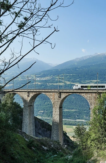
When the pioneering Lötschberg tunnel and railway line opened in 1913, the new route provided the first year-round link between Valais and the Swiss capital. Together with the Simplon tunnel, it offered a fast and comfortable way of travelling across and under the Alps.
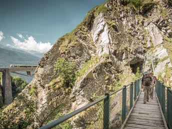
The stretch of line south of the tunnel is the setting for one of the region’s best-loved hikes: the Lötschberger-Südrampe («Lötschberg south ramp»). To celebrate the line’s centenary, the trail was extended from Lalden station all the way to the historical town of Brig.
Our hike begins at Eggerberg, just west of Lalden, about 200 vertical metres above the valley floor. From here it traverses the sunny, south-facing slopes until dropping down to the Rhône by Brig. The railway is quieter following the opening of another pioneering line in 2007: the Lötschberg base tunnel, 400 vertical metres lower, which can accommodate trains travelling at up to 250 km/h.
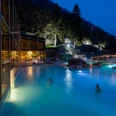
The first stretch of the hike leads fairly close to the railway line until it passes the Brigerbad thermal pool complex down on the valley floor. With its 12 indoor and outdoor pools, its water slides and spa, this is one of the country’s largest thermal spa facilities.
The trail now traces a route some way above the railway line: first below the saffron-growing village of Mund, then along a «Suone» irrigation channel, the Driestneri, created to provide water for the line’s fire prevention installations.
Just before reaching Naters, the trail passes over a former top-secret underground fortress. Today this hosts two museums: one devoted to the site’s military history, and another to the Swiss Guard in the Vatican, for which Naters has supplied more soldiers than any other Swiss municipality.
The south ramp is mostly walked in the direction of Brig, but it is also very attractive in the opposite direction.
Highlights:
- Theme trail with info panels exploring more than a century of pioneering rail history
- Sunny position, open views across Rhône valley
- Two fascinating museums plus Brig: historical charm and Mediterranean atmosphere
Good to know
Pavements
Best to visit
Directions
Starting from Eggerberg railway station, the trail is clearly marked throughout.
The first stretch of path follows a route a short distance uphill of the railway line, before crossing it via a footbridge after about 1.7 km. The trail now follows the line closely as it leads above the villages of Lalden and Brigerbad on the valley floor. As the trail approaches the Brigerbad thermal pool complex, it re-crosses the railway and traces a route uphill of the line all the way to Brig. The entrance to the underground museums in Naters lies a couple of minutes’ walk to the right of our hike.
The full Lötschberger-Südrampe trail leads from Hohtenn railway station via Eggerberg to Brig: a distance of about 27 km.
The full trail also forms the final half of the Walliser Sonnenweg («Valais Sun Trail»), a long-distance hike that leads in 4 day-stages from Crans-Montana to Brig.
Tour information
Cultural Interesting
Stop at an Inn
Equipment
We recommend:
- good footwear
- clothing suitable for the weather: always carry a waterproof jacket
- hat or cap
- sunscreen
- bottle for water
- picnic
- camera
- binoculars (optional)
- hiking poles (optional)
- printout of this hike (click «Print» icon, to download)
For certain walks:
- Swimwear
Directions & Parking facilities
Regular train connections from all over Switzerland to Brig, then change onto «RegioExpress» to Eggerberg.
Find full timetable information at bls.ch/en. You can hike the Lötschberg south ramp in its entirety or in sections. Starting points are the Hohtenn, Ausserberg, Eggerberg, Lalden and Brig stops.
Additional information
More information about the destination:
Literature
Author´s Tip / Recommendation of the author
Safety guidelines
Die Nutzung der Wanderwege und Informationen auf dieser Webseite erfolgt auf eigenes Risiko. Die Konditionen vor Ort können allenfalls Änderungen der Route bewirken. Valais/Wallis Promotion übernimmt keine Verantwortung für die Genauigkeit und Vollständigkeit der Informationen auf dieser Webseite.
When planning, take into account participants’ fitness level and ability. All riding is at one’s own risk.
Für alle Wanderungen:
- Führen Sie eine Karte mit sich. Laden Sie die komplette Beschreibung des Wanderwegs mit einer Karte in grossem Massstab herunter, indem Sie auf «Drucken» oben rechts auf der Seite klicken.
- Benutzen Sie ausschliesslich markierte Wanderwege und berücksichtigen Sie alle Wegweiser und Anweisungen - zu Ihrer eigenen Sicherheit, zum Schutz von weidenden Tieren und in Respekt von Wildtieren.
- Schliessen Sie Tore nach dem Durchgang wieder.
- Verhalten Sie sich rücksichtsvoll gegenüber anderen Wegbenutzern, Pflanzen und Tieren.
Für Bergwanderungen:
- Führen Sie einen zusätzlichen Sonnenschutz mit. UV-Strahlen in Höhenlagen können sehr stark sein, sogar bei bedecktem Wetter.
- Planen Sie Ihre Wanderung sorgfältig: Beachten Sie dabei das erforderliche Fitness Level von allen Teilnehmern, Wettervorhersagen und Saisonabhängigkeiten.
- Die Wetterbedingungen können in den Bergen sehr schnell und ohne Vorwarnung ändern. Eine angemessene Kleidung und ausreichend Proviant (Essen und Trinken) sind sehr wichtig. Bei unbeständigem Wetter, kehren Sie besser frühzeitig um.
Für hochalpine Wanderungen:
- Informieren Sie Ihre Familie über Ihre Wanderroute. Wenn möglich, vermeiden Sie es, alleine unterwegs zu sein.
- Begeben Sie sich nicht auf Gletscher ohne einen Bergführer.
- Beachten Sie Warnsignale, die auf Gefahren hinweisen an Flussufern, entlang von Wasserläufen unterhalb von Staudämmen und Stauseen: Der Wasserstand kann schnell und ohne Warnung ansteigen.
Map
Nearby