- Photos & Map
How would you like to arrive?
- Description
- Good to know
- Nearby
Download GPX file
- 4:45 h
- 4.93 km
- 1,461 m
- 13 m
- 1,798 m
- 3,265 m
- 1,467 m
- Start: Engeloch
- Destination: Böshorn or Rothorn
Ascent
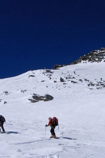
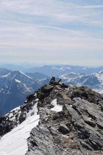
Engeloch – Ascent from Engeloch in the Ritzibach valley to the Wysse Bode plateau. A steep slope leads southwards beneath rock bands. You cross them east of the waterfall on a ramp ascending from left to right. Then go left towards the western Sirwoltesee passing a first rock band. Climb until you face west, traversing an exposed ledge towards the snow saddle and cross it. Then steep ascent southwards, staying slightly to the left. Keep southeast through a long hollow, then ascend the increasingly steep northeast slope towards the eastern ridge of the Böshorn. Ski depot at approx. 3200 m at the foot of the rocks. Climb the exposed ridge on good rock to the summit.
Descent
Engeloch – The descent follows the ascent track. Depending on hazard assessment, variations are possible.
Egga – From Sirwoltesee at the foot of the north face, ascend eastwards to a saddle (approx. 2600 m) between Schilthorns and Wyssbodehorn (2623 m). Cross the pass and descend eastwards into the beautiful Wysse Bode hollow. Descend to its end. Turn right and descend southwards over a ridge to Rossbodestafel. Reach Simplon road near Egga in the gently wooded valley floor.
Good to know
Best to visit
Directions
This ski route requires a very safe avalanche situation, as well as good fitness, alpine experience, and skiing technique.
Ascent / Descent
A) Normal route from Chlusmatte. Difficulty ZS
- Ascent / Descent: 1461m | Uphill on descent: 0m
- Start altitude: 1804 m a.s.l. | Target altitude: 3265 m a.s.l.
- Ascent time: 4¾ h | Distance: 5.3 km
- Places on the route: Chlusmatte - Wysse Bode (Simplon - VS)
Snowshoe and ski touring map 1:50000 is available at the Brig and Simplon tourist offices.
274S Visp ISBN number: 978-3-302-20274-7
Tour information
Loop Road
Summit
Equipment
Directions & Parking facilities
You can comfortably reach Engeloch by post bus.
Stop: Engeloch
Additional information
Further information on ski tours at: www.sac-cas.ch/de/huetten-und-touren
Questions about the Brig Simplon region: www.brig-simplon.ch
Literature
Further information at the tourist office or from the SAC.
Author´s Tip / Recommendation of the author
Visit a restaurant in Simplon village or on the Simplon pass.
Benefit from the new Simplon snowshoe and ski touring app. Collect points and receive great rewards. The app is available at simplon.app.
Safety guidelines
You undertake the route at your own risk. Rapid weather changes can occur. Be careful and avoid putting yourself in danger.
Safe skiing, alpine, quite difficult route. Only manageable under very safe conditions.
Disclaimer
Traversing routes in alpine terrain requires good fitness, serious preparation, and technical knowledge in mountaineering. Undertaking the described routes is at your own risk. Brig Simplon Tourismus AG, SAC, and the authors assume no liability for the up-to-dateness, correctness, and completeness of the provided information. Liability claims of any kind against Brig Simplon Tourismus AG or against the authors are excluded.
SOS : 144
Map
Snowshoe and ski touring map 1:50000 is available at the Brig and Simplon tourist offices.
274S Visp ISBN number: 978-3-302-20274-7
Nearby


