- Photos & Map
How would you like to arrive?
- Description
- Good to know
- Nearby
- 3:45 h
- 10.98 km
- 535 m
- 835 m
- 1,521 m
- 2,110 m
- 589 m
- Start: Rosswald, 1,819 m
- Destination: Berisal 1,525 m
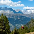
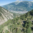
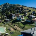
The route to the Bortelhütte leads you through very different landscapes. From Rosswald, which is conveniently accessible by cable car, the path gains altitude on the way to Bortelalp and leaves the noise and hustle of the city further and further behind. From the car-free sunny terrace at Simplon, the path winds past larch forests over alpine pastures with grazing sheep and ascends in steps up to the Bortelhütte. Now a generous view opens over the Ganter valley, the Ganter bridge, and the Glishorn.
Take your time and enjoy the hike to the Bortelhütte on the Alpine pass route. Here you find our offer hut hike.
Good to know
Pavements
Best to visit
Directions
From Ried-Brig you take the cable car to Rosswald, where the hiking route crosses the central parking lot. The alp is closed to car traffic. The route then follows along the "Bergwasser" channel to the Stafelalp. There the path slopes down to the right and requires sure footing. From Stafel you follow the signs towards Bortelalp. After about one kilometer, those who are not afraid of heights can take the path to the right and hike above the channel into the Steinutal valley. Those who do not dare should better take the left fork and reach Steinutal via the slope of Seewjistafel. However, this variant takes 40 to 60 minutes longer. From Steinutal you go up to the Steinuchäller and continue on the hiking path to the Bortelhütte. After a well-deserved rest in the hut, you descend to Berisal.
Tour information
Stop at an Inn
Equipment
We recommend:
- Good footwear
- Weather-dependent clothing: always carry a waterproof vest
- Headgear
- Sunscreen
- Water bottle
- Picnic
- Camera
- Binoculars (optional)
- Hiking poles (optional)
- Printout of the hiking route (click "Print" to download)
For certain hikes:
- Swimsuit
Directions & Parking facilities
It is worthwhile to switch to public transport in Brig (see description of public transport access).
From Brig train station, take the post bus to Ried-Brig valley station. Take the cable car up to Rosswald to the starting point of the hike heading towards the Bortelhütte. At the destination, you can take the post bus again, which takes you back to the train station in Brig.
Additional information
Further information is available at the tourism offices in Rosswald (in the Magusii grocery store) and Brig.
Literature
Author´s Tip / Recommendation of the author
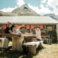
The Bortelhütte is located on the Alpine pass route between Rosswald and the Simplon Pass. It is worth spending a night here and enjoying the sunset in the mountain hut.
Safety guidelines
People undertaking this activity based on the information on this website do so at their own risk. Conditions on site may lead to route changes and increased danger from natural hazards. We accept no responsibility for the accuracy of the information on this website or for the conditions under which this activity is conducted. If in doubt, please contact the destination in advance.
For all hikes:
• Always carry a map. Download the complete description of the hiking route with a large-scale map by clicking "Print" at the top right of the page.
• Use only marked hiking trails and observe all signs and instructions—for your own safety, to protect grazing animals, and to avoid disturbing wildlife.
• Close gates after passing through.
• Behave considerately towards other trail users, plants, and animals.
For mountain hikes:
• Carry additional sunscreen. UV rays at high altitude can be very strong, even in cloudy weather.
• Plan your hike carefully: take into account the required fitness level of all participants, weather forecasts, and seasonal dependencies.
• Weather conditions can change very quickly and without warning in the mountains. Appropriate clothing and sufficient provisions (food and drink) are very important. In unstable weather, it is better to turn back early.
For high alpine hikes:
• Inform your family about your hiking route. Avoid hiking alone if possible.
• Do not venture onto glaciers without a mountain guide.
• Observe warning signs indicating dangers at riverbanks, along watercourses below dams and reservoirs: water levels can rise quickly and without warning.
Preparation for a hike
https://www.valais.ch/de/aktivitaeten/wandern/vorbereitung-auf-einewanderung
Map
Nearby


