- Photos & Map
How would you like to arrive?
- Description
- Good to know
- Nearby
Download GPX file
- 2:00 h
- 4.58 km
- 178 m
- 178 m
- 1,977 m
- 2,106 m
- 129 m
- Start: Simplon Pass, Monte Leone
- Destination: Simplon Pass, Monte Leone
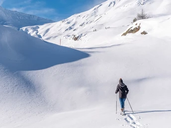
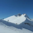
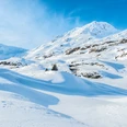
The snowshoe trail leads over the Simplon Pass to the hill "Weng." While walking, you enjoy a 360° view of the surrounding mountains. At the beginning, the Fletschhorn dominates. After about 30 minutes, hikers get a view north into the Aletsch area and the Bernese Alps. Thanks to its sunny location, the trail is passable early in winter. The hike is especially beautiful after fresh snow. Thanks to its high altitude and flat plains, the Simplon Pass is a wonderful hiking area. In winter, the pass landscape shows an undiscovered, romantic side. At the Simplon Hospice or restaurants, winter sports enthusiasts can refresh themselves or warm up after the hike.
Good to know
Pavements
Best to visit
Directions
The snowshoe hike begins at the Restaurant Monte Leone, where the Postbus stop "Simplon, Monte Leone" is also located. The entrance to the trail is on the right side of the building behind the garages. The pink marking posts are clearly visible from the road.
The route crosses the plains on the Simplon Pass heading north. Following the marking posts, winter sports enthusiasts ascend to an altitude of around 2,100 m above sea level. Along the way, you pass through a varied landscape. At the start of the hike, you overlook the area southwest of the Simplon Pass. In the foreground, Gampisch, Spittelmatte, Old Spittel, and Barralhaus can be seen. In the background, the peaks of Fletschhorn, Böshorn/Rauthorn, Galehorn, … tower.
At some points, especially after fresh snow, caution is advised. Slides can occur on the slopes.
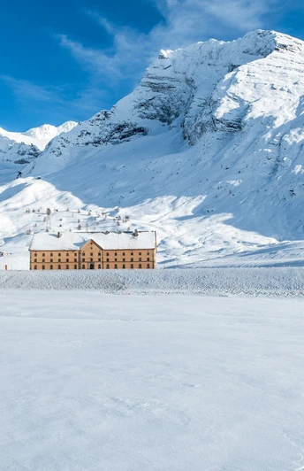
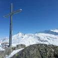
After the ascent to 2,100 meters, hikers overlook the Simplon Pass. The Simplon Hospice at the foot of the Hübschhorn is clearly visible. The mountain peaks to the east are also beautifully visible – Bortelhorn, Wasenhorn, Monte Leone, and Breithorn up to the Hübschhorn.
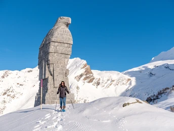
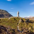
The route leads down to the alp plateau "Hopsche" and further east past the "Hopschusee". Shortly after, you see the proud 9-meter-high Simplon Eagle, along which the route also passes. The last descent from the Simplon Eagle leads down to the entry level.
It is also possible to start the route from the Simplon Hospice parking lot. In this case, you go through the underpass of the national road to the entry level near the Hotel Monte Leone.
Tour information
Loop Road
Stop at an Inn
Equipment
Our recommendation:
- Good and waterproof footwear
- Snowshoes
- Walking sticks
Weather-dependent (waterproof) and warm clothing
Headwear
Sun protection
Provisions
Camera
Printout of the hiking trail (click "Print" to download)
You can rent snowshoe equipment in Naters at Glacier-Sport. (+41 27 923 46 46)
Directions & Parking facilities
By car or Postbus to the Simplon Pass.
Additional information
Brig Simplon Tourismus AG
Bahnhofstrasse 2
3900 Brig
+41 27 9201 60 30
Literature
Author´s Tip / Recommendation of the author
On the Simplon Pass, after a successful hike, restaurants (Hospiz, Hotel Monte Leone, Hotel Simplonblick) invite you to enjoy a warm cup of tea.
Safety guidelines
The use of snowshoe routes and information on this website is at your own risk. Conditions on site may lead to changes to the route. Valais/Wallis Promotion and Brig Simplon Tourism AG accept no responsibility for the accuracy and completeness of the information on this website.
- Carry a map with you. Download the complete description of the hiking trail with a large-scale map by clicking "Print" at the top right of the page.
- Use only marked hiking trails and observe all signs and instructions – for your own safety, to protect grazing animals, and out of respect for wildlife.
- Be considerate of other trail users and the landscape. Take your waste and that of others with you.
- Carry additional sun protection. UV rays at high altitudes can be very strong, especially in winter, even in cloudy weather.
- Plan your hike carefully: consider the fitness level required by all participants, weather forecasts, and seasonal dependencies.
- Inform a third party about the route and, if possible, never go alone.
- Weather conditions can change very quickly and without warning in the mountains. Appropriate clothing and sufficient provisions (food and drink) are very important. In unstable weather, it is better to turn back early.
- Do not go on glaciers without a mountain guide.
- Observe warning signs indicating dangers.
Map
Nearby


